Starting My Ancient Greece Map Project
Yesterday I got this crazy idea in my shower – why not make a map of ancient Greece around 700 BCE? Sounds simple right? Well turns out it’s like trying to find a specific grain of sand on the beach.
First thing I did was fire up my laptop and start searching online. Typed “ancient Greek cities map 700 BC” expecting some clear answers. Big mistake. Got a million websites all showing different stuff. Some showed Athens smaller than my thumbnail, others made it huge. Felt like everyone was just guessing where stuff really was.
The Real Hunt Begins
Dug through piles of old books I’ve got collecting dust. Found one from the 80s with hand-drawn maps – looked like some kid’s art project. The names were spelled all weird too. Corinth was “Korinthos” and Thebes was “Thebai”? Seriously?
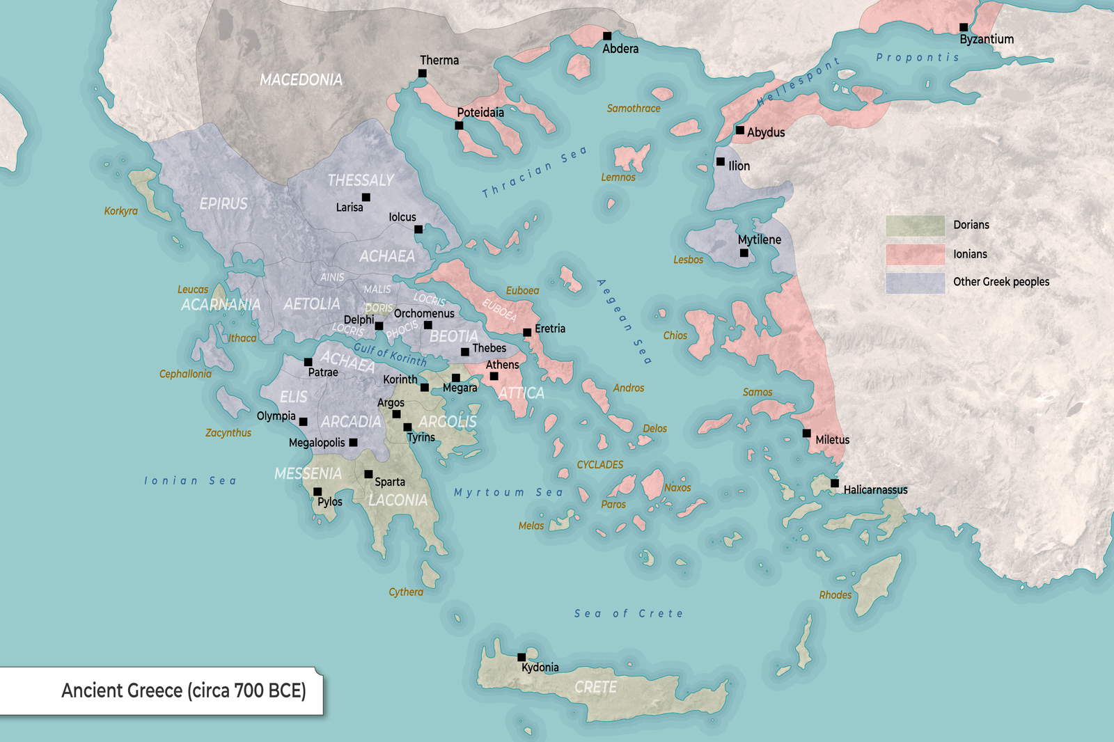
Tried comparing three different sources at once:
- That crusty old book from my shelf
- A digital museum collection
- Some professor’s research paper
Ended up with three totally different locations for Sparta. Wanted to throw my laptop out the window.
Putting Pieces Together
Finally decided to make my own damn map. Grabbed a blank map template that looked close enough. Started placing dots for cities where most sources agreed:
- Athens in Attica
- Sparta down in Laconia
- Corinth right on that skinny land bridge
Noticed how tiny all the city-states were. My town’s shopping mall would’ve covered like three ancient cities.
Added special symbols for oracle spots and temples. Delphi got this funky triangle symbol. Took me forever to remember which god owned which place. Zeus here, Poseidon there – felt like I was doing divine real estate.
The Headache Moments
Couldn’t find crap about the northern tribes. Searched for “Thracian settlements 700 BC” and got recipes for Greek salad. Seriously people? Also ran into the “island problem” – turns out back then lots of tiny islands didn’t even have names. Just called them “that rock near Crete”.
Nearly gave up when I hit the coastline mess. Shorelines changed so much in 2700 years! Some cities that used to be on coasts are now inland. My first version looked like Greece after an earthquake.
The Final Stretch
Sat there for hours moving dots millimeter by millimeter. Added labels using this old-timey font to make it look legit. Used different dot sizes for “important cities” versus “that one village nobody remembers”.
When I finally saved the file, it was 3AM. Made some coffee and looked at this thing I created. Not perfect – no chance. But there it was: Athens, Thebes, Sparta, Delphi all sitting pretty. Even remembered tiny Eretria up north.
Checked next morning with blurry eyes. Realized I put Mount Olympus where it definitely wasn’t. Had to redo that part. Classic me moment. But overall? Feels good to see those little dots telling stories of people walking around 2700 years back. Weird how this big messy project made history feel alive.